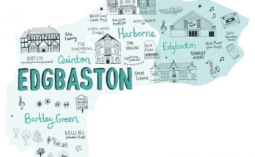
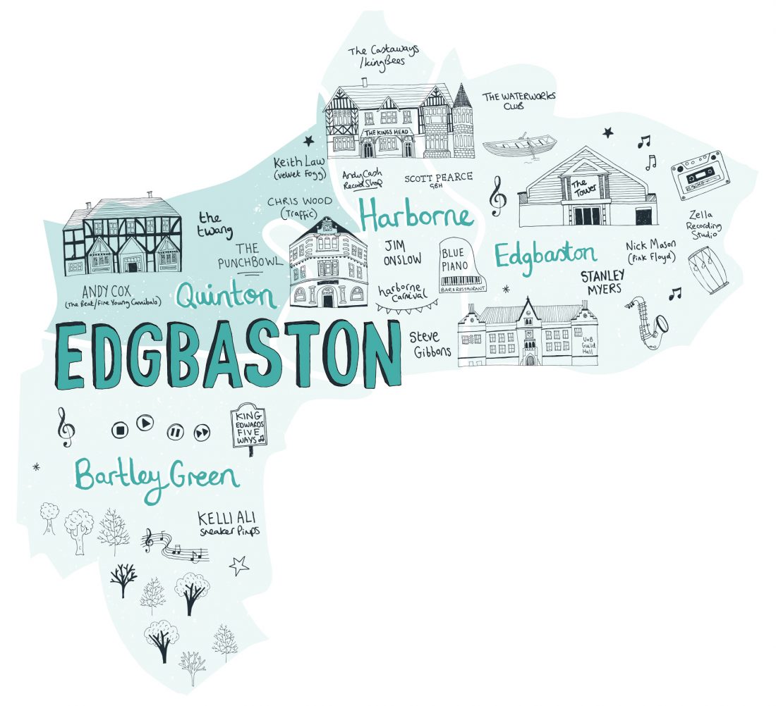
Quinton
Part of the Edgbaston district
Quinton Ward lies around five miles west of the city centre along the Hagley Road West.
Originally it was a small village, also known as “Ridgeacre”, and was home to a mixture of small farms and nail-making industries. It now stretches to the borders of Halesowen, Warley and Harborne.
Explore Quinton
Show All
Sounds
Blog posts
Videos
Photos
Project news
for-wards pilot
Composition


In 1894 a map showed Quinton as being along High Street and Bissell Street, whilst the agricultural land around it was known as Ridgeacre. Farms included, Red Hall Farm, near to where Quinton Library now is; Windmill Farm along Ridgeacre Lane; Ridgeacre Farm by the junction of Quinton Road West and Ridgeacre Lane; Four Dwellings Farm where Four Dwellings School is and Mopbeggar Farm near to Moats Meadow.
On November 9th 1909, Quinton became part of the ever-expanding Birmingham. Only residential homes were planned for the area. This was due to the gentry of Edgbaston not wanting unpleasant odours from factories reaching them, as the wind blew from Quinton to Edgbaston!
The next century saw a constant expansion in the provision of housing. Today, the area is still residential. Most of its green spaces have disappeared, although some do remain. Quinton Meadows (a site of importance for nature conservation) borders the 1960s M5 development and a new business park recently built on some of the Meadowland. The recreation ground still remains and Woodgate Valley Country Park and Pitts Wood provide timely reminders of the wards rural, Greenfield heritage.